A wildfire in California’s Siskiyou Mountains has prompted evacuation orders and road closures.
Related Articles
Congressman Sam Liccardo unveils partnership to bolster wildfire resistance in West Valley
Air attack stifles wildfire in rugged terrain above Corralitos
Local agencies work to spark West Valley residents’ interest in wildfire mitigation
Pickett Fire containment rises to 21% as Napa County issues health emergency over debris
Garnet Fire: Firefighters try to corral forest blaze as lightning strikes bring risk of new ignitions
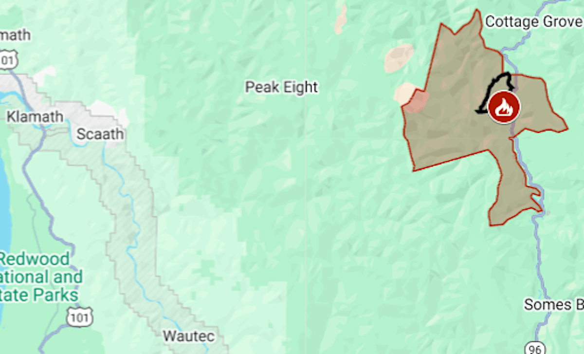
The Dillon Fire had burned 2,134 acres (3.4 square miles) by Wednesday morning, the national forest fire management team said.
It was reported Monday, Aug. 25, in the Ti Bar area along the Klamath River, south of Cottage Grove. The cause is under investigation.
The map above shows the evacuation order in red and the approximate fire perimeter in black. Updates and details, including warning areas, can be found on the Genasys Protect map or the Ready Siskiyou site.
One-way traffic controls were in effect on Highway 96 in the area of the fire.
Dozens of wildfires started Aug. 24-26 in California’s mountainous areas as lightning storms moved through. Most were limited to less than 5 acres, but a few grew to require evacuation orders — including Fresno County’s Garnet Fire, now the state’s fifth-biggest wildfire of the summer.