A shelter-in-place order was issued for residents near a wildfire that started early Thursday along Interstate 5 in northern Los Angeles County.
Related Articles
Long-shot ballot initiative could have huge effect on California insurance
While Los Angeles burned, rules to protect homes from wildfires were on hold
Landing Fire in Santa Cruz County contained
Wildfires, storms and blazing heat forecast for western US
Evacuation orders lifted as firefighters make progress on Canyon fire
The order included a recreational-vehicle park near the King Fire’s ignition site. Beyond the shelter-in-place zone, evacuation warnings were issued.
I-5 was briefly closed in both directions, but by 4 a.m. some lanes were reopened.
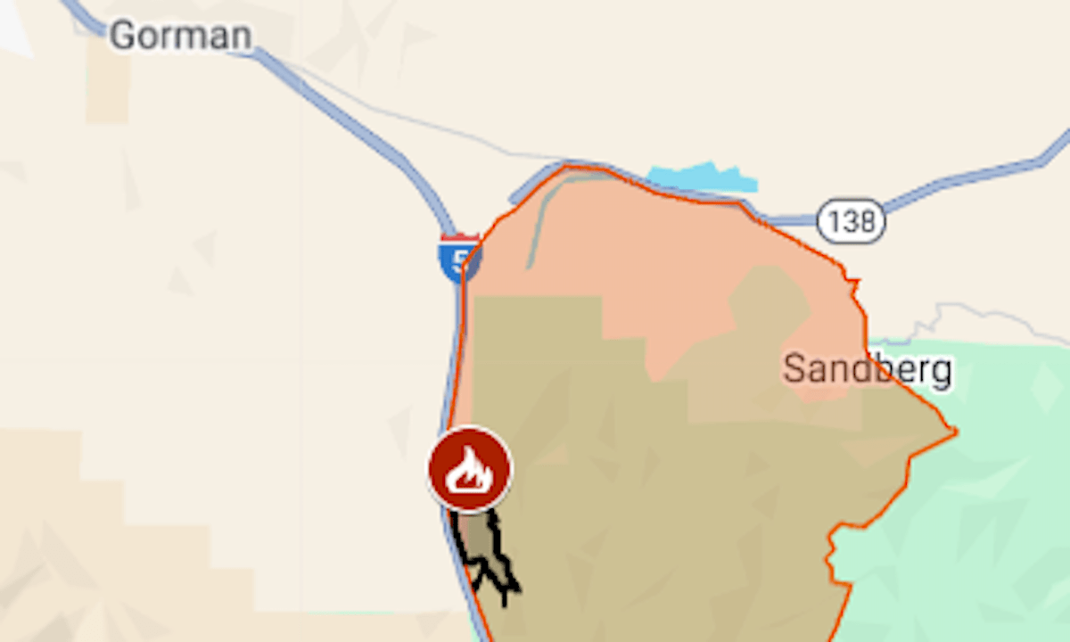
Around sunrise Thursday, Aug. 14, the fire was mapped at 490 acres with 5% containment, the Los Angeles County Fire Department said. It was burning on the east side of the freeway just north of Pyramid Lake.
The map above shows the shelter-in-place area in orange and the approximate fire perimeter as a black line.
For updates and details including the warning area, see the Los Angeles County emergency website or Genasys Protect.