A fire reported on the afternoon of Tuesday, June 10, grew to more than 4,000 acres in several hours and prompted evacuations in a high desert community in San Bernardino County.
Related Articles
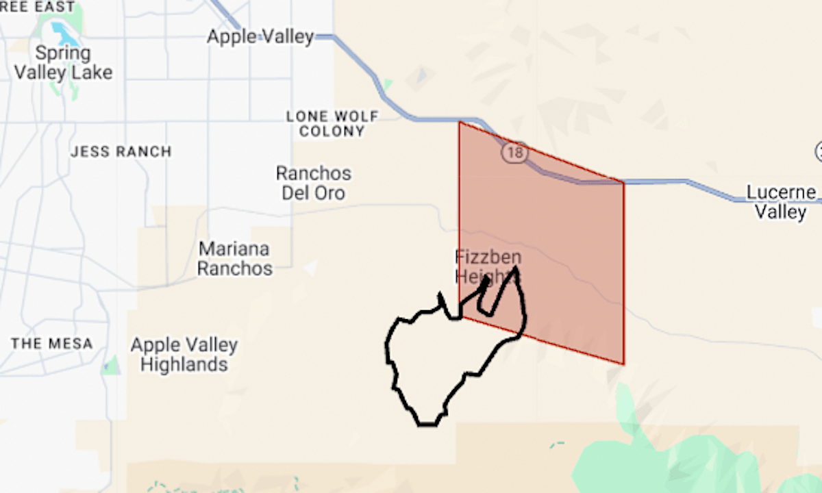
Wildfire Map; Ranch fire burning in Southern California
Morgan Hill adds all-electric fire station
As funding battle continues, Bay Area AmeriCorps programs feel both hope and worry
With cancer the leading cause of death for firefighters, one East Bay FD is partnering with a Silicon Valley biotech company to improve the odds
New map shows Bay Area locations with highest risk of ember-driven wildfires
The Ranch Fire began in rugged terrain in the northern foothills of the San Bernardino Mountains and burned into Fizzben Heights, southeast of Apple Valley.
The map above shows the evacuation area in red and the approximate perimeter in black. As of Wednesday morning, it was at 4,205 acres (6½ square miles) with 10% containment, said the California Department of Forestry and Fire Protection.
The evacuation order remained in effect Wednesday. For latest updates, see the San Bernardino County emergency site.
Ranch is California’s second-largest wildfire since January, when fires burned about 55,000 acres in Los Angeles County.