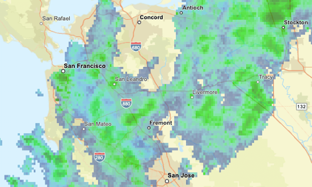
Rain started falling in the Bay Area on Monday morning and was expected to continue into the night.
Related Articles
‘Pretty notable early season storm’ on track to hit Bay Area next week
La Niña is here: Is California heading for a dry winter?
Bay Area weather to cool down as low pressure approaches region
Correction: Rainy Bay Area weather about to give way to sunny weekend
How much rain did the Bay Area get this week? Here’s where the most fell
The updating radar map above shows current areas of precipitation in green, with greater intensities indicated by yellow and orange.
The low-pressure system will be accompanied by gusty winds up to 35 mph in the Bay Area hills and possible thunderstorms and hail, the National Weather Service said. The heaviest rainfall was expected during the evening commute.
In the Sierra Nevada, heavy snow was forecast for Lake Tahoe and a flood watch was in effect for Yosemite.