As expected, Bay Area temperatures soared again on Tuesday, expectedly even more so than in the previous 24 hours and enough to bring a heat advisory.
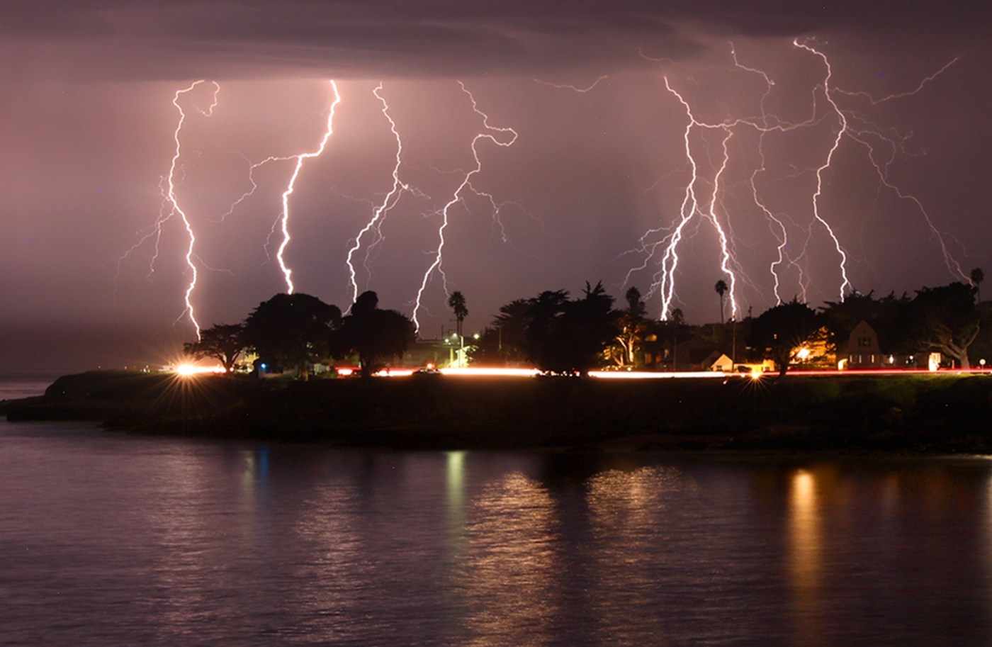
Unexpectedly, the rain that was supposed to follow the heat’s exit was delayed in its arrival, so the lightning expectations that are coating part of the Bay Area were pushed back to Wednesday.
Related Articles
Bay Area weather expected to be a carbon copy of previous week
Bay Area dodges thunderstorms, humid weather on the horizon
Threat of Bay Area dry lightning lessens as hot spell begins to fade
Bay Area heat to return briefly, but dry lightning looms as threat
Bay Area’s warm rain, mugginess to be replaced by hot and dry conditions
So were the hopes that any lightning might be surrounded by substantial precipitation.
“The chance for rain continues to decrease as this system moves north,” National Weather Service meteorologist Dylan Flynn said Tuesday. “So the other thing to watch is that lightning could become more dry in the central part of the Bay Area and the North Bay.”
It’s a situation that Flynn said the NWS is monitoring. For now, they expect the earliest the rain will arrive is early Wednesday. The moisture is coming from the remnants of a tropical storm off the Mexico coast and is expected to hit the Central Coast, likely Monterey County — “That’s where I’d put my money,” Flynn said — before migrating slowly north.
Flynn said it’s unlikely that Santa Clara or Santa Cruz counties will be affected. Lightning is possible in Alameda and Contra Costa counties, he said.
As for the heat, it is expected to drop 15-20 degrees in the hottest places, though it may not feel that way. The low 80s and high 70s that will dot the region’s warmest spots will come with humidity that’s expected to reach at least 50%.
The blast Tuesday followed an appetizer on Monday in which the hottest spots got into the mid-90s. The weather service issued a heat advisory that started at 11 a.m. and was set to last until 7 p.m.
The Tuesday temperatures were expected to hit 99 degrees in Antioch and 98 in Concord in Contra Costa County. Livermore and Pleasanton also were expected to get to 98 in Alameda County, while Oakland was expected to hit 87. Morgan Hill was expected to max at 98 degrees in the South Bay, and San Jose was forecast to hit 94.
“You might see a couple of individual thermometers that crack 100,” Flynn said. “But it’s mostly an upper-90s thing where it’s the hottest.”
The less steamy weather is expected to continue into Thursday after the storm departs. Temperatures are expected to spike Friday into the upper 80s in the hottest places before falling off and becoming more seasonable into and through the weekend.