After lightning sparked fires across the Sierra Nevada foothills, evacuations were ordered Tuesday for several communities along Highway 4.
Related Articles
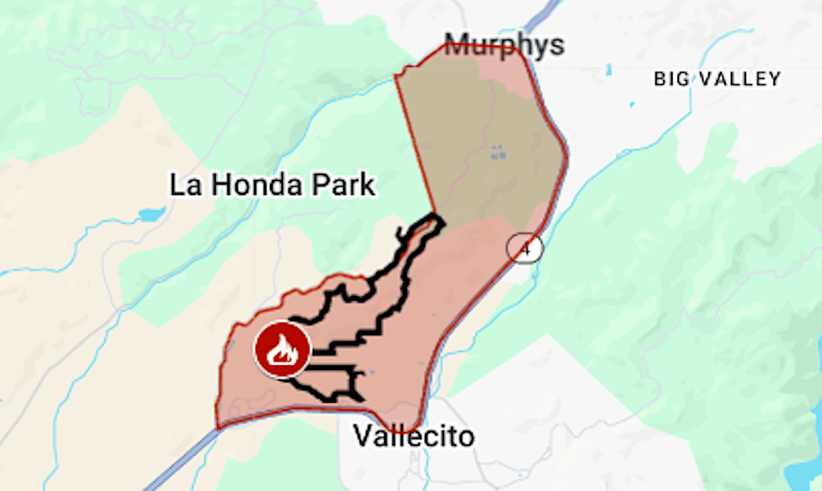
Map: Garnet Fire evacuation zone still expanding after a week
Castro Valley fire is fully contained
Fire breaks out near Interstate 280 in Woodside
Border Patrol arrests 2 firefighters for being in the country illegally as they battled Washington’s biggest wildfire
‘A different experience’ imagined at Big Basin Redwoods State Park 5 years after the CZU fires
Parts of Vallecito, Douglas Flat and Murphys were included in the evacuation order for the 2-7 Fire, which by midafternoon Tuesday had burned 500 acres, according to the California Department of Forestry and Fire Protection.
Another evacuation order covered a less populated area near Don Pedro Reservoir, where the 6-5 Fire had burned 3,000 acres.
Those two fires were among nine making up the TCU September Lightning Complex, in Tuolumne and Calaveras counties.
The map above shows the 2-7 Fire as the large fire icon, and some of the other fires as dots. The evacuation areas are shown in red. Updates and details, including warning areas, can be found on the Genasys Protect map (Calaveras) or the Tuolumne County emergency map.
As of Tuesday afternoon, Cal Fire gave this accounting of the complex’s fires:
1-2 Fire: 15 acres / Hogback Ridge, west of San Andreas
2-2 Fire: 1,300 acres / Highway 4 at Dutton, west of Copperopolis
2-3 Fire: 20 acres / Copper Cove Court at O’Byrnes Ferry Road, Copperopolis
2-7 Fire: 451 acres / Six Mile Road, Vallecito
2-8 Fire: 499 acres / Little John Road, Copperopolis
4-5 Fire: 2 acres / McCormick Meadows, south of Arnold
5-2 Fire: 5-10 acres / Lyons Bald Mountain Road, Sonora
6-2 Fire: 40 acres / Old Don Pedro Road, west of Jamestown
6-5 Fire: 2,955 acres / Red Hills, west of Jamestown