A spate of wildfires thought to have been sparked by lightning prompted evacuation orders for more than 200 square miles of Sierra National Forest in Fresno County.
Related Articles
Pickett Fire: Containment on region’s largest wildfire this year grows to 13%
Pickett Fire grows to nearly 6,000 acres, firefighters battling ‘challenging’ conditions into Sunday morning
Growing Pickett Fire prompts new Napa County evacuation orders Saturday
Pickett Fire expands in Napa County mountains east of Calistoga as firefighters make gains on second day
Crews contain grassland fire at Camp Parks near Dublin
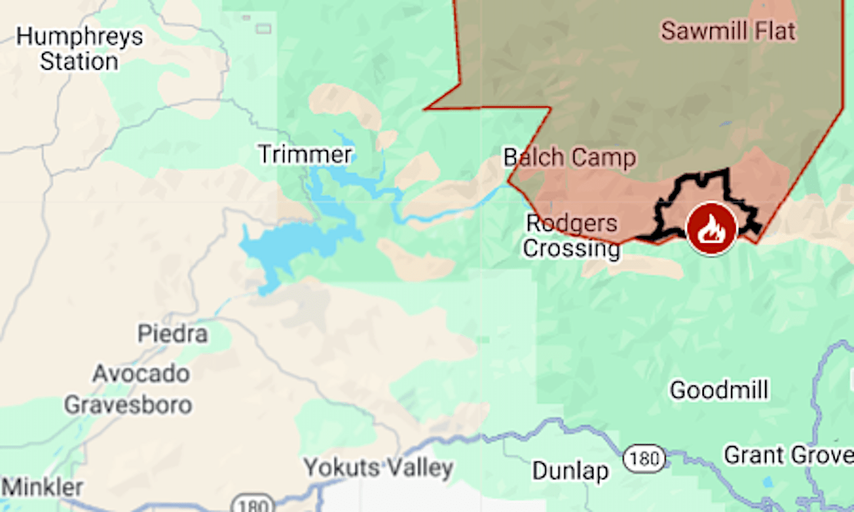
The biggest of the nine confirmed fires that ignited Aug. 23-24 is Garnet, which by Monday, Aug. 25, had burned 4,442 acres (7 square miles) north of Kings River, the California Department of Forestry and Fire Protection said.
Evacuation orders issued on Sunday evening remained in place Monday.
The map above shows the evacuation area in red and the approximate fire perimeter as a black line. Updates and details, including evacuation warning zones, can be found at Fresno County’s emergency website.