A fire burning near Silverado Trail wineries prompted evacuation orders in Napa County.
Related Articles
Map: Coyote Fire burning near footprint of 2021’s Caldor
Saratoga’s FireSafe Council gets $185k grant for wildfire resilience projects
Man gets 73 years for murders, arson that sparked deadly Bay Area wildfire
Elias: Playing fireman, Trump has actually increased California’s fire risk
Map: Shelter-in-place lifted for King Fire on I-5 Grapevine
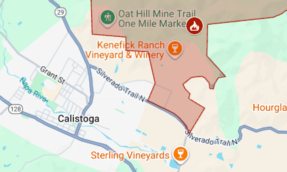
The Pickett Fire was reported around 3 p.m. on Thursday, Aug. 21, off Pickett Road, near Calistoga. Within an hour, it was at 50 acres, and evacuations were ordered for 6 square miles.
The map above shows the evacuation area in red. Updates and details, including warning zones, can be found on the Genasys Protect map or ReadyNapaCounty.gov. The evacuation center is the Calistoga Community Center, 1307 Washington St.
The evacuation zone abuts the Four Seasons resort property. Wineries in the area include Eisele, Poggi, Kenefick Ranch, Kelly Fleming, Venge and Phifer Pavitt.
The area was under a heat advisory until 10 p.m. Thursday, and temperatures reached 100 in Calistoga.