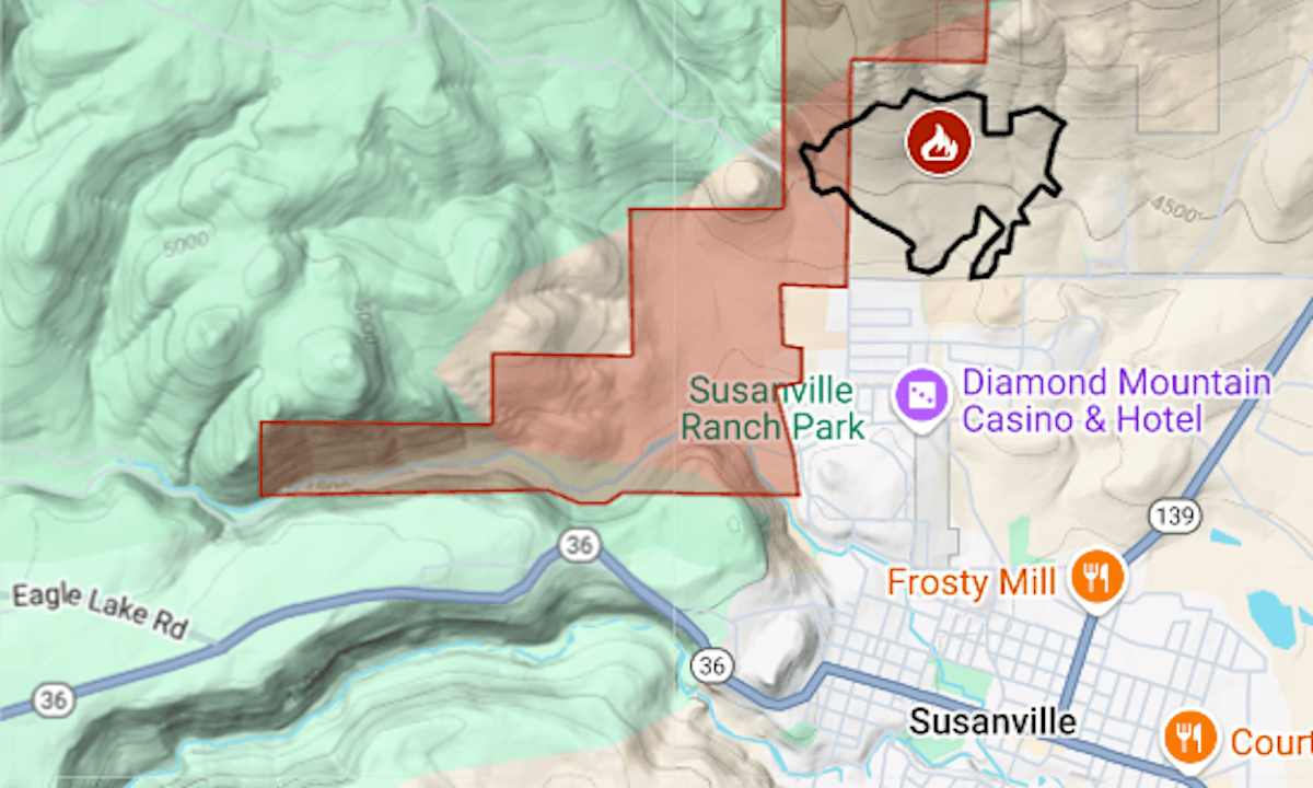
Evacuations were ordered at the edge of Susanville because of a wildfire that started Thursday afternoon.
Related Articles
PG&E monthly bills have ‘stabilized’ and will drop lower, utility says
Gov. Newsom seeks $18 billion for utilities’ wildfire fund as California faces future blazes
Value of homes impacted by California wildfire totaled almost $52 billion
Berkeley’s new accessory dwelling unit policy aims for balance
Mercury to seek new home insurance rates using California’s risk modeling system
As of 8:30 p.m. on July 31, about four hours after it was reported, the 1-4 Fire had burned 259 acres, mostly within the Susanville Indian Rancheria, the California Department of Forestry and Fire Protection said.
The evacuation orders did not cover any of the city’s residential neighborhoods. Pineview Mobile Home Park, though just yards from the fire, was also excluded.
The map above shows the evacuation zone in red and the approximate fire perimeter as a black line. For updates and details of the evacuation, including warning zones, see the Genasys Protect emergency map.