The Butler Fire grew by 40% over the weekend, and more evacuations were ordered Sunday in the mountains of Siskiyou County.
Related Articles
5 dead in collision that sparks California brush fire
Southern California wildfire victims building ADUs as first step in home rebuilding process
Map: Butler Fire crosses Salmon River, more evacuations ordered
Map: Dale Fire evacuation zone
Map: Butler Fire evacuation zone expanded
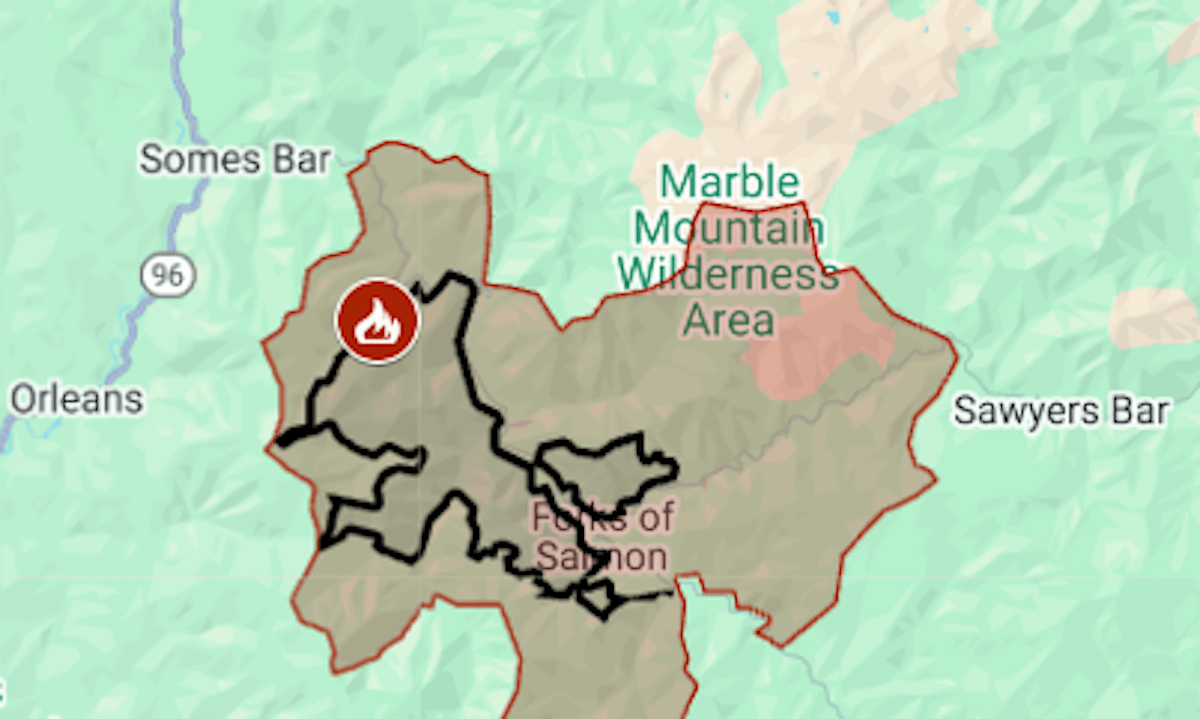
The wildfire, sparked by lightning on July 3, was mapped at a little more than 12,000 acres on the afternoon of Friday, July 18. By Monday morning it had burned 17,116 acres (26.7 square miles) and was 6% contained, the California Department of Forestry and Fire Protection said. It is the larger fire in the Orleans Complex.
Two more evacuation zones were added at Siskiyou County’s southwest edge.
The map above shows the evacuation area in red and the approximate fire perimeter as a black line. For updates and details of the evacuation, including warning areas, see the Genasys Protect map or the Siskiyou County emergency website.
Evacuation orders have also been issued for the Green Fire, burning since July 1 near Shasta Lake. On Sunday, July 20, it was estimated at 19,021 acres (29.7 square miles), California’s third biggest wildfire of the year.